
County on-line survey asks, at a time of diminishing resources, what priorities should our civic leaders set for our community? The San Mateo County Board of Supervisors will use the results in setting future priorities.
MCC Special Meeting July 18, 2012
Special meeting at 7:30 pm 7/18/12 at Granada Sanitary District meeting room, 504 Ave. Alhambra, 3rd Floor, El Granada, to continue discussion of the Draft Midcoast Highway 1 Action Plan in a new format, gather public comments and discuss proposed priorities and time frames for the Highway 1 improvement projects.
UPDATE: 7/18/12 MINUTES
Coastal Erosion Meeting July 19 in Pacifica
A Regional Sediment (sand) Management Plan (RSMP) for San Francisco to Pacifica is being developed: Upcoming meeting in Pacifica July 19, 7-9pm, City Council Chambers, 2212 Beach Blvd. Begun in 2011, the plan is expected to be completed in spring 2013. The State Coastal Sediment Management Workgroup (CSMW) has identified a number of California littoral cells for regional planning, but the San Mateo Midcoast and Half Moon Bay are not on the list. See Harbor/shoreline Issues Page for more local erosion info.
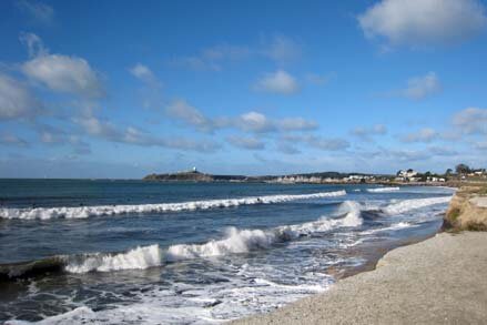
UPDATE: Report by L. Ketcham on the 7/19/12 Regional Sediment (Sand) Management Plan (RSMP) meeting:
The meeting was about the San Francisco RSMP (south to Pt San Pedro) 2011-spr 2013. The coastline is divided into littoral cells which are considered to be separate from each other as far as exchange of sediment goes, by rocky points or underwater canyons. RSMPs do not involve new research on local shoreline sediment movement. They simply document past and present shoreline conditions, forecast conditions 50 years out including sea level rise, and describe a variety of possible steps that local governments can take if they choose. No specific projects are proposed in the RSMPs.
A future RSMP is proposed for Santa Cruz, and Supervisor Horsley has written the Army Corps in support of expanding the scope of that study north to Pillar Point, which is actually the northern boundary of the Santa Cruz littoral cell.
These RSMPs are DIFFERENT from the ongoing Surfers Beach/Pillar Point Harbor erosion study (begun 2009), which is a standard US Army Corps project related to mitigation of damages caused by federal navigation projects, in this case the harbor breakwater. If the harbor study’s feasibility phase shows a positive benefit-to-cost ratio, a specific project alternative will be developed in detail. There will probably be a public workshop with updates on this study this fall. The Harbor District asked for and is the local sponsor of this study, however they did not ask for the Princeton shoreline to be included. I discussed this with John Dingler of the Army Corps at the Pacifica meeting and he said he was glad I brought it up and he would look into it.
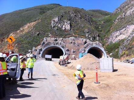
Devil's Slide California Coastal Trail Planning
New documents received from County Parks regarding planning for conversion of the old Devil's Slide roadbed into a park and segment of the California Coastal Trail (CCT) once the tunnel opens:
Final Draft Devil's Slide Trail Management Plan, 7/13/12
Devil's Slide Park Construction Timeline (7/13/12)
Rancho Corral de Tierra Neighbors Meeting July 28, 11am-1pm
Hosted by National Park Service and Golden Gate National Parks Conservancy (RSVP and more info)
-sandwiches, lemonade, cookies
-meet your Park Service neighbors
-learn about latest planning efforts and events
-share your ideas on how to improve the park
-sign up for volunteer opportunities
Location: Moss Beach Ranch (at Horse Camp Area), 1862 Etheldore
Walk, bike, or carpool please!